North Atlantic fisheries could face new risks from ocean circulation collapse
Sophy Oliver, National Oceanography Centre
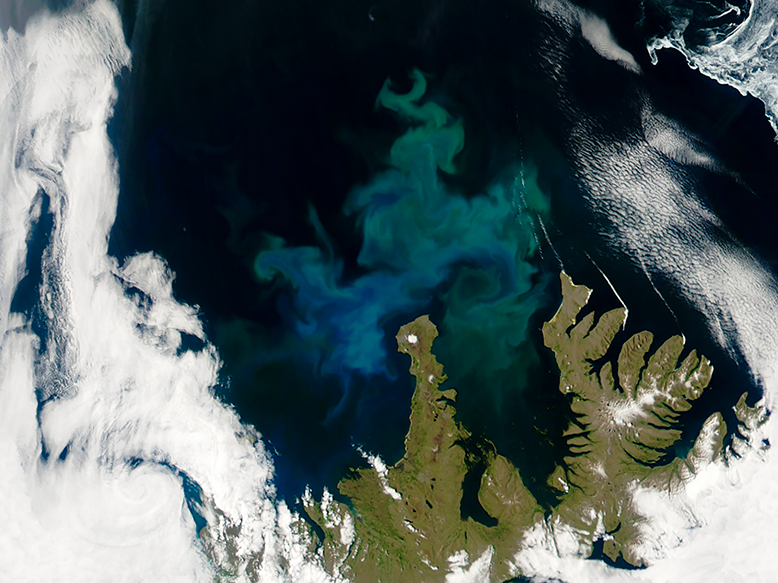
Scientists are investigating how a potential collapse of deep winter ocean convection in the North Atlantic could affect some of the world’s most important fishing grounds. The Subpolar gyre plays a crucial role in bringing nutrient-rich waters to the surface, supporting annual phytoplankton blooms that form the foundation of the marine food web. Climate model projections suggest this convection system could weaken or collapse abruptly within the coming decades, leading to declines in nutrients, phytoplankton and other key components of the ecosystem as early as the 2040s.
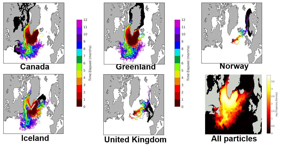
The concern extends well beyond the subpolar gyre itself. Using ocean particle-tracking experiments, researchers found that waters originating in the region are connected to areas around Iceland, Greenland, Canada and the UK within approximately a year. Because species such as zooplankton and fish larvae depend on the productivity of these waters, changes in the subpolar gyre could ripple through the wider North Atlantic food web, potentially affecting commercially important fisheries far from the original source of disruption.
To assess the potential impacts, researchers are developing a framework that combines ocean connectivity with measures of national dependence on fisheries, including fishing activity, export revenues, dietary reliance on fish and economic capacity to adapt. The approach aims to identify which countries may be most vulnerable to ecosystem changes linked to a weakening subpolar gyre convection system. While the work remains at an early stage, it could provide valuable insights into how climate-driven changes in ocean circulation may affect food security, coastal economies and fishing communities across the North Atlantic.